Marshland | |
|---|---|
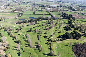
 Windsor Golf Course with Marshland in the distance | |
 | |
| Coordinates: 43°28′30″S 172°39′07″E / 43.475°S 172.652°E | |
| Country | New Zealand |
| City | Christchurch |
| Local authority | Christchurch City Council |
| Electoral ward |
|
| Community board |
|
| Area | |
| • Land | 896 ha (2,214 acres) |
| Population (June 2024)[2] | |
• Total | 1,310 |
| Belfast | Kainga | Bottle Lake |
| Redwood |
|
Prestons |
| Northcote | Mairehau | Shirley |
Marshland is a semi-rural suburb on the northern side of Christchurch city. The land is primarily used for horticulture and dairy farming.[3]
The suburb is named for the peaty soil, and was also called Rhodes' Swamp after landowner and politician Robert Heaton Rhodes (1815–1884).[4]
State Highway 74 forms the western and southern boundary of the suburb. The Styx River runs northeast through Marshland.[5]
- ^ Cite error: The named reference
Areawas invoked but never defined (see the help page). - ^ "Aotearoa Data Explorer". Statistics New Zealand. Retrieved 26 October 2024.
- ^ "Marshland". New Zealand Ministry for Culture and Heritage. Retrieved 10 September 2021.
- ^ "Christchurch Place Names: A - M : Islington" (PDF). Christchurch City Libraries. February 2016. p. 179.
- ^ Harriss, Gavin (April 2021). Marshland, Canterbury (Map).