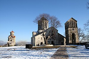
Martvili Municipality | |
|---|---|
 | |
 Location of the municipality within Georgia | |
| Country | |
| Region | Samegrelo-Zemo Svaneti |
| Administrative centre | Martvili |
| Government | |
| • Body | Martvili Municipal Assembly |
| • Mayor | Tornike Janashia |
| Area | |
• Total | 880.6 km2 (340.0 sq mi) |
| Population (2014) | |
• Total | 33,463 |
| • Density | 38.0/km2 (98/sq mi) |
| Population by ethnicity[1] | |
| • Georgians | 99,8 % |
| • Russians | 0,1 % |
| Time zone | UTC+4 (Georgian Standard Time) |
| Website | http://www.martvili.gov.ge |


Martvili (Georgian: მარტვილის მუნიციპალიტეტი) is a district of Georgia, in the region of Samegrelo-Zemo Svaneti. Its main town is Martvili. Martvili Municipality is located in the north-eastern part of western Georgia. It is bordered by Lentekhi in the north, Khoni and Tsageri in the east, Abasha in the south, Senaki and Chkhorotsku in the west. The southern part of the Martvili area is occupied by a lowland that rises from southwest to northeast from 60 to 170 meters. The highest place, the headwaters of Tekhuri is located at 3003 meters above sea level. To the south-west of the municipality is the Askha Mountain Range, which is rich in karst caves, waterfalls, mineral deposits and limestone. The mountains of Lebarde, Chekola and Dviri are rich in healing mineral waters.
- ^ "Ethnic composition of Georgia 2014". mashke.org. Archived from the original on 2018-11-04.

