| Marysville Victoria | |||||||||
|---|---|---|---|---|---|---|---|---|---|
 The main street of Marysville in winter, before the fires of February 2009. | |||||||||
| Coordinates | 37°30′0″S 145°44′0″E / 37.50000°S 145.73333°E | ||||||||
| Population | 501 (2021 census)[1] | ||||||||
| Postcode(s) | 3779 | ||||||||
| Elevation | 430 m (1,411 ft) | ||||||||
| Location |
| ||||||||
| LGA(s) | Shire of Murrindindi | ||||||||
| State electorate(s) | Eildon | ||||||||
| Federal division(s) | Indi | ||||||||
| |||||||||
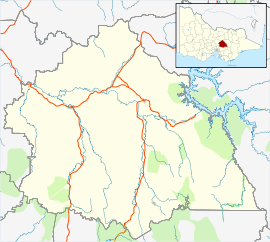
Marysville is a town in the Shire of Murrindindi in Victoria, Australia, about 34 kilometres north-east of Healesville and 41 kilometres south of Alexandra. The town, which previously had a population of over 500 people,[2] was devastated by the Murrindindi Mill bushfire on 7 February 2009. On 19 February 2009 the official death toll was 45. Around 90% of the town's buildings were destroyed.[3][4][5][6][7] Prior to the Black Saturday fire the population in 2006 was 519.[8] At the 2011 Census, the population had reduced to 226,[9] by the 2016 census it had risen to 394.[10]
- ^ Australian Bureau of Statistics (28 June 2022). "Marysville (Suburb and Locality)". 2021 Census QuickStats. Retrieved 16 July 2024.
- ^ Australian Bureau of Statistics (25 October 2007). "Marysville (State Suburb)". 2006 Census QuickStats. Retrieved 9 July 2018.
- ^ "Marysville destroyed by Victorian bushfires". The Australian. 8 February 2009. Archived from the original on 11 February 2009. Retrieved 16 July 2024.
- ^ Cowan, Jane (8 February 2009). "Wiped out: Town destroyed by killer fires". ABC News. Retrieved 16 July 2024.
- ^ Ham, Larissa (8 February 2009). "Marysville destroyed". Brisbane Times. Retrieved 16 July 2024.
- ^ "25 confirmed dead in Victorian fires". ABC News. 8 February 2009. Archived from the original on 9 February 2009. Retrieved 16 July 2024.
- ^ Lannen, Danny (9 February 2009). "Marysville just wiped out". Geelong Advertiser. Archived from the original on 12 February 2009. Retrieved 16 July 2024.
- ^ "2006 Census QuickStats: Marysville (L)".
- ^ "2011 Census QuickStats: 3779, Vic".
- ^ Australian Bureau of Statistics (27 June 2017). "Marysville (State Suburb)". 2016 Census QuickStats. Retrieved 16 July 2024.
