Maseru | |
|---|---|
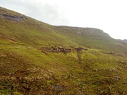
 Baboons Pass, Maseru District | |
 Map of Lesotho with the district highlighted | |
| Country | |
| Capital | Maseru |
| Area | |
• Total | 4,279 km2 (1,652 sq mi) |
| Population (2016) | |
• Total | 519,186 |
| • Density | 120/km2 (310/sq mi) |
| Time zone | UTC+2 (CAT) |
| Area code | +266 |
| HDI (2019) | 0.560[1] medium · 1st |
Maseru is a district of Lesotho. Maseru is also the name of the district's capital, and is the only city in the district and also the capital of the country. It is the largest urban area in the country, and therefore the only city. The city of Maseru is located on Lesotho's western border with the Free State Province of South Africa, the frontier being the Caledon River. Maseru borders on Berea District in north, Thaba-Tseka District in the east, Mohale's Hoek District in south, and Mafeteng District in southwest.
As of 2006, the district had a population of 431,998 which was 23.02 per cent of the total population of the country. The total area of the district was 4,279 which was 14.10 per cent of the total area of the country. The density of population in the district was 101.00 per km2. As of 2008, there were 52 economically active people in the district. There were totally 294,062 employed people out of a total of 585,770 people in the district above 15 years of age.
- ^ "Sub-national HDI - Area Database - Global Data Lab". hdi.globaldatalab.org. Retrieved 2018-09-13.