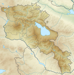
Masis
Մասիս | |
|---|---|
 The centre of Masis with Saint Thaddeus Church | |
| Coordinates: 40°03′48″N 44°26′27″E / 40.06333°N 44.44083°E | |
| Country | Armenia |
| Province | Ararat |
| Municipality | Masis |
| Founded | 1953 |
| Area | |
• Total | 5.7 km2 (2.2 sq mi) |
| Elevation | 854 m (2,802 ft) |
| Population (2022 census) | |
• Total | 20,081[1] |
| • Rank | Armenia: 15th |
| Time zone | UTC+4 |
| Area code | +374(236) |
| Website | Official website |
| Sources: Population[2] | |
Masis (Armenian: Մասիս) is a town and administrative centre of the Masis Municipality of the Ararat Province of Armenia, located on the left bank of the Hrazdan River, 9 km southwest of Yerevan towards Mount Ararat. The town has a large railroad commodity station that serves Yerevan, and used to connect the capital city with the Nakhichevan Autonomous Soviet Socialist Republic until the closing of the border with Azerbaijan.
Masis is one of the closest settlements to Mount Ararat and Little Ararat. The mountains are visible from most of the areas in the town.
As of the 2011 census, the population of the town was 20,215. As per the 2016 official estimate, the town has a population of 18,500. As of the 2022 census, the population of the town was 20,081 and is the biggest town in the Ararat Province.[1]
- ^ a b "The Main Results of RA Census 2022, trilingual / Armenian Statistical Service of Republic of Armenia". www.armstat.am. Retrieved 2024-11-07.
- ^ 2011 Armenia census, Ararat Province

