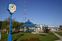
Matagami | |
|---|---|
 View of Matagami | |
| Coordinates (195, boulevard Matagami[2]): 49°45′30″N 77°37′19″W / 49.75833°N 77.62194°W[1][3] | |
| Country | Canada |
| Province | Quebec |
| Region | Nord-du-Québec |
| RCM | None |
| Constituted | 1 April 1963 |
| Government | |
| • Mayor | René Dubé |
| • Federal riding | Abitibi—Baie-James—Nunavik—Eeyou |
| • Prov. riding | Ungava |
| Area | |
• Total | 65.10 km2 (25.14 sq mi) |
| • Land | 66.85 km2 (25.81 sq mi) |
| There is an apparent contradiction between two authoritative sources | |
| Population (2011)[4] | |
• Total | 1,526 |
| • Density | 22.8/km2 (59/sq mi) |
| • Change (2006–11) | |
| • Dwellings | 719 |
| Time zone | UTC−05:00 (EST) |
| • Summer (DST) | UTC−04:00 (EDT) |
| Postal code(s) | |
| Area code | 819 |
| Website | www |
Matagami (/mətɑːɡəmi/, French pronunciation: [mataɡami]) is a small town in Quebec, Canada. It is located north of Amos, on Matagami Lake, at the northern terminus of Route 109 and the start of the James Bay Road (French: Route de la Baie James). It is enclaved within the local municipality of Eeyou Istchee James Bay, but administratively independent of it. The town had a population of 1,526 as of the Canada 2011 Census.
- ^ "Matagami". Geographical Names Data Base. Natural Resources Canada.
- ^ a b c Cite error: The named reference
mamrotwas invoked but never defined (see the help page). - ^ Cite error: The named reference
toponymiewas invoked but never defined (see the help page). - ^ a b Cite error: The named reference
cp2011was invoked but never defined (see the help page).
