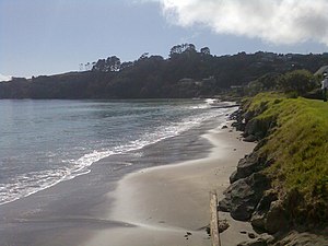
Matakatia | |
|---|---|
 Tindalls Beach | |
 | |
| Coordinates: 36°37′15″S 174°46′45″E / 36.620720°S 174.779100°E | |
| Country | New Zealand |
| City | Auckland |
| Local authority | Auckland Council |
| Electoral ward | Albany ward |
| Local board | Hibiscus and Bays |
| Area | |
| • Land | 293 ha (724 acres) |
| Population (June 2024)[2] | |
| • Total | 2,150 |
| Postcode(s) | 0930 |
| Tindalls Beach | Gulf Harbour | |
| (Polkinghornes Bay) |
|
Gulf Harbour |
| Manly | (Matakatia Bay) |
Matakatia is a suburb situated on the Whangaparaoa Peninsula, towards the northern end of Auckland, New Zealand. It is about 43 kilometres (by road) north of the city centre.
Kotanui Island, also called Frenchmans Cap, is a sharp triangular rock rising from the water about 1,000 metres offshore.[3]
- ^ Cite error: The named reference
Areawas invoked but never defined (see the help page). - ^ "Aotearoa Data Explorer". Statistics New Zealand. Retrieved 26 October 2024.
- ^ "Drone operator captures incredible aerial footage of Auckland's Hibiscus Coast". Stuff. 2 November 2016.