Matewan, West Virginia | |
|---|---|
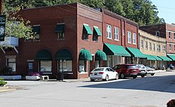
 Matewan, West Virginia. | |
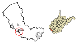
 Location of Matewan in Mingo County, West Virginia. | |
| Coordinates: 37°37′23″N 82°9′59″W / 37.62306°N 82.16639°W | |
| Country | United States |
| State | West Virginia |
| County | Mingo |
| Government | |
| Area | |
| • Total | 0.55 sq mi (1.43 km2) |
| • Land | 0.55 sq mi (1.43 km2) |
| • Water | 0.00 sq mi (0.00 km2) |
| Elevation | 705 ft (215 m) |
| Population | |
| • Total | 412 |
| Time zone | UTC-5 (Eastern (EST)) |
| • Summer (DST) | UTC-4 (EDT) |
| ZIP code | 25678 |
| Area code | 304 |
| FIPS code | 54-52324[3] |
| GNIS feature ID | 1542862[4] |
Matewan (/ˈmeɪtwɒn/) is a town in Mingo County, West Virginia, United States at the confluence of the Tug Fork River and Mate Creek. The population was 412 at the 2020 census, down from 499 in 2010.[6] The Norfolk Southern Railway's Pocahontas District passes through the town. It was a key site of the Coal Wars and the location of the Battle of Matewan in 1920.
- ^ "2019 U.S. Gazetteer Files". United States Census Bureau. Retrieved August 7, 2020.
- ^ Cite error: The named reference
wwwcensusgovwas invoked but never defined (see the help page). - ^ "U.S. Census website". United States Census Bureau. Retrieved January 31, 2008.
- ^ "US Board on Geographic Names". United States Geological Survey. October 25, 2007. Retrieved January 31, 2008.
- ^ Cite error: The named reference
USCensusEst2019CenPopScriptOnlyDirtyFixDoNotUsewas invoked but never defined (see the help page). - ^ US Census Bureau, 2020 Results, Matewan town, West Virginia