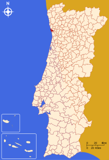
Matosinhos | |
|---|---|
 | |
| Coordinates: 41°11′N 8°42′W / 41.183°N 8.700°W | |
| Country | |
| Region | Norte |
| Metropolitan area | Porto |
| District | Porto |
| Parishes | 4 |
| Government | |
| • President | Luísa Salgueiro (PS) |
| Area | |
• Total | 62.42 km2 (24.10 sq mi) |
| Population (2021) | |
• Total | 172,557 |
| • Density | 2,800/km2 (7,200/sq mi) |
| Time zone | UTC+00:00 (WET) |
| • Summer (DST) | UTC+01:00 (WEST) |
| Website | http://www.cm-matosinhos.pt |
Matosinhos (Portuguese pronunciation: [mɐtuˈziɲuʃ] ) is a city and a municipality in the district of Porto in Portugal.
The municipality covers an area of approximately 62.42 square kilometres (24.10 sq mi)[1] and in 2011, it hosted a population 172,557 people.[2] It is bordered by the municipalities of Porto to the south, Maia to the east and Vila do Conde to the north and the Atlantic Ocean lies to its west. It is a part of the Porto metropolitan area, the second largest urban area in Portugal.
The city of Matosinhos had 45,703[3] inhabitants in 2001 and is the seat of the municipality. It is located on the southern shore of the mouth of the Leça River, only 8 km away from Porto's city center. There are two other cities within the municipality, São Mamede de Infesta and Senhora da Hora, both located east of Matosinhos and just north of Porto municipality.
- ^ "Áreas das freguesias, concelhos, distritos e país". Archived from the original on 2018-11-05. Retrieved 2018-11-05.
- ^ INE, ed. (2021), Censos (in Portuguese), Lisbon, Portugal: Instituto Nacional de Estatística
- ^ Nuno Pires Soares (2004), IGP (ed.), Uma População Que Se Urbaniza: Uma avaliação recente – Cidades [Population of urban area] (in Portuguese), Instituto Geográfico Português, archived from the original on 2014-10-06


