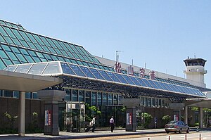
Matsuyama Airport 松山空港 Matsuyama kūkō | |||||||||||
|---|---|---|---|---|---|---|---|---|---|---|---|
 | |||||||||||
| Summary | |||||||||||
| Airport type | Public | ||||||||||
| Operator | Ministry of Land, Infrastructure, Transport and Tourism | ||||||||||
| Serves | Matsuyama | ||||||||||
| Elevation AMSL | 13 ft / 4 m | ||||||||||
| Coordinates | 33°49′38″N 132°41′59″E / 33.82722°N 132.69972°E | ||||||||||
| Website | www.matsuyama-airport.co.jp | ||||||||||
| Map | |||||||||||
 | |||||||||||
| Runways | |||||||||||
| |||||||||||
| Statistics (2015) | |||||||||||
| |||||||||||
Source: Japanese Ministry of Land, Infrastructure, Transport and Tourism[1] | |||||||||||

Matsuyama Airport (松山空港, Matsuyama kūkō) (IATA: MYJ, ICAO: RJOM) is an airport located 3 NM (5.6 km; 3.5 mi) west-southwest[2] of the center of Matsuyama, Ehime Prefecture, Japan. The airport was built on the coastline facing the Seto Inland Sea. In 2018, the airport had approximately 3.2 million passengers, the busiest in the Chugoku-Shikoku region, surpassing Hiroshima Airport.
- ^ "Matsuyama Airport" (PDF). Japanese Ministry of Land, Infrastructure, Transport and Tourism. Archived from the original (PDF) on 21 October 2016. Retrieved 7 January 2017.
- ^ AIS Japan Archived 17 May 2016 at the Portuguese Web Archive

