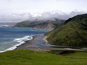
| Mattole River | |
|---|---|
 Mattole River Estuary | |
| Native name | Mattóal (Mattole) |
| Location | |
| Country | United States |
| State | California |
| Region | Mendocino County, Humboldt County |
| Cities | Petrolia, Whitethorn, Honeydew |
| Physical characteristics | |
| Source | King Range |
| • location | 11 mi (18 km) southwest of Redway, California |
| • coordinates | 39°59′7″N 123°58′19″W / 39.98528°N 123.97194°W[1] |
| • elevation | 1,780 ft (540 m) |
| Mouth | Pacific Ocean |
• location | 4 mi (6 km) west of Petrolia, California |
• coordinates | 40°18′8″N 124°21′14″W / 40.30222°N 124.35389°W[1] |
• elevation | 0 ft (0 m) |
| Length | 62 mi (100 km) |
| Basin size | 304 sq mi (790 km2) |
| Discharge | |
| • location | Petrolia |
| • average | 1,288 cu ft/s (36.5 m3/s) |
| • minimum | 11 cu ft/s (0.31 m3/s) |
| • maximum | 90,400 cu ft/s (2,560 m3/s) |
The Mattole River is a river on the north coast of California, that flows northerly, then westerly into the Pacific Ocean. The vast majority of its 62 miles (100 km) course is through southern Humboldt County, though a short section of the river flows through northern Mendocino County. Communities, from north to south, closely associated with the Mattole River include: Petrolia, Honeydew, Ettersburg, Thorn Junction, and Whitethorn. The river enters the ocean at the Mattole Estuary about 4 miles (6.4 km) west-southwest of Petrolia and 10 miles (16 km) south of Cape Mendocino.
