Mayantoc | |
|---|---|
| Municipality of Mayantoc | |
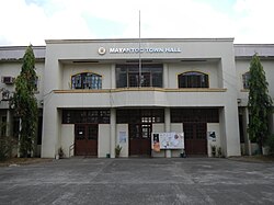
 Municipal Hall | |
 Map of Tarlac with Mayantoc highlighted | |
Location within the Philippines | |
| Coordinates: 15°37′13″N 120°22′39″E / 15.6203°N 120.3775°E | |
| Country | Philippines |
| Region | Central Luzon |
| Province | Tarlac |
| District | 1st district |
| Founded | 1917 |
| Barangays | 24 (see Barangays) |
| Government | |
| • Type | Sangguniang Bayan |
| • Mayor | Iluminado E. Pobre jr. |
| • Vice Mayor | Venus Razalan Tomas |
| • Representative | Carlos O. Cojuangco |
| • Electorate | 21,300 voters (2022) |
| Area | |
| • Total | 311.42 km2 (120.24 sq mi) |
| Elevation | 58 m (190 ft) |
| Highest elevation | 262 m (860 ft) |
| Lowest elevation | 21 m (69 ft) |
| Population (2020 census)[3] | |
| • Total | 32,597 |
| • Density | 100/km2 (270/sq mi) |
| • Households | 8,232 |
| Economy | |
| • Income class | 3rd municipal income class |
| • Poverty incidence | 14.34 |
| • Revenue | ₱ 167.8 million (2020) |
| • Assets | ₱ 350.5 million (2020) |
| • Expenditure | ₱ 148.8 million (2020) |
| • Liabilities | ₱ 51.6 million (2020) |
| Service provider | |
| • Electricity | Tarlac 1 Electric Cooperative (TARELCO 1) |
| Time zone | UTC+8 (PST) |
| ZIP code | 2304 |
| PSGC | |
| IDD : area code | +63 (0)45 |
| Native languages | Pangasinan Tagalog Kapampangan Ilocano |
| Website | www |
Mayantoc, officially the Municipality of Mayantoc (Pangasinan: Baley na Mayantoc; Ilocano: Ili ti Mayantoc; Tagalog: Bayan ng Mayantoc), is a 3rd class municipality in the province of Tarlac, Philippines. According to the 2020 census, it has a population of 32,597 people.[3]
It is nestled in the foothills of the Zambales Mountains where the Camiling River originates and provides many scenic picnic and swimming sites, making it known as the summer capital of the province. The most common road to Mayantoc starts at "Crossing Mayantoc", at the national highway to Camiling, Tarlac just after the then Tarlac College of Agriculture (now the Tarlac Agricultural University) campus.
- ^ Municipality of Mayantoc | (DILG)
- ^ "2015 Census of Population, Report No. 3 – Population, Land Area, and Population Density" (PDF). Philippine Statistics Authority. Quezon City, Philippines. August 2016. ISSN 0117-1453. Archived (PDF) from the original on May 25, 2021. Retrieved July 16, 2021.
- ^ a b Census of Population (2020). "Region III (Central Luzon)". Total Population by Province, City, Municipality and Barangay. Philippine Statistics Authority. Retrieved 8 July 2021.
- ^ "PSA Releases the 2021 City and Municipal Level Poverty Estimates". Philippine Statistics Authority. 2 April 2024. Retrieved 28 April 2024.


