Mayfield Historic District | |
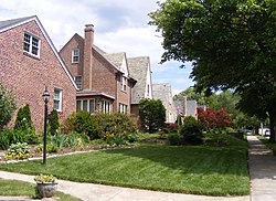
 Homes in Mayfield. | |
| Location | Lake Montebello Rd.-Chesterfield Ave.,-Crossland Ave.-Erdman Ave., Baltimore, Maryland |
|---|---|
| Coordinates | 39°19′49″N 76°34′48″W / 39.33028°N 76.58000°W |
| Area | 93 acres (38 ha) |
| Architect | Eyring, John; et.al. |
| Architectural style | Late 19th And 20th Century Revivals, Late 19th And Early 20th Century American Movements |
| NRHP reference No. | 03001371[1] |
| Added to NRHP | January 6, 2004 |
Mayfield is a quaint and historic community in northeast Baltimore, Maryland. It is bounded by Erdman Avenue on the south, Chesterfield Avenue on the north, Crossland Avenue on the east and Lake Montebello on the north and west. Homeowners belong to the Mayfield Improvement Association.[2][3]
- ^ "National Register Information System". National Register of Historic Places. National Park Service. July 9, 2010.
- ^ "Neighborhood Resources: COMMUNITY ASSOCIATIONS". BNIA-University of Baltimore The Jacob France Institute. Archived from the original on 2008-06-02. Retrieved 2008-05-09.
- ^ Fred B. Shoken (June 2003). "National Register of Historic Places Registration: Mayfield Historic District" (PDF). Maryland Historical Trust. Retrieved 2016-04-01.
 This article incorporates public domain material from websites or documents of the National Park Service.


