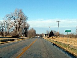
Maysville, Arkansas | |
|---|---|
 Maysville southern limits, February 2013 | |
 Location of Maysville in Benton County, Arkansas. | |
| Coordinates: 36°24′13″N 94°36′07″W / 36.40361°N 94.60194°W | |
| Country | United States |
| State | Arkansas |
| County | Benton |
| Area | |
| • Total | 2.35 sq mi (6.10 km2) |
| • Land | 2.35 sq mi (6.10 km2) |
| • Water | 0.00 sq mi (0.00 km2) |
| Elevation | 1,043 ft (318 m) |
| Population (2020) | |
| • Total | 117 |
| • Density | 49.70/sq mi (19.19/km2) |
| Time zone | UTC-6 (Central (CST)) |
| • Summer (DST) | UTC-5 (CDT) |
| Area code | 479 |
| GNIS feature ID | 77622[2] |
Maysville is an unincorporated community and census-designated place (CDP) in Benton County, Arkansas, United States. It is the westernmost settlement in the state of Arkansas.[3] Per the 2020 census, the population was 117.[4] It is located in the Northwest Arkansas region.
- ^ "2020 U.S. Gazetteer Files". United States Census Bureau. Retrieved October 29, 2021.
- ^ a b U.S. Geological Survey Geographic Names Information System: Maysville, Arkansas
- ^ "EXTREME SETTLEMENTS: A COMPREHENSIVE LIST". Weekend Roady. May 2, 2013. Retrieved August 20, 2014.
- ^ "Maysville CDP, Arkansas". United States Census Bureau. Retrieved April 15, 2022.
