McDade, Texas | |
|---|---|
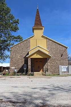
 McDade Baptist Church, February 2015 | |
| Coordinates: 30°16′58″N 97°15′05″W / 30.28278°N 97.25139°W | |
| Country | United States |
| State | Texas |
| County | Bastrop |
| Area | |
| • Total | 4.0 sq mi (10 km2) |
| • Land | 4.0 sq mi (10 km2) |
| • Water | 0.0 sq mi (0 km2) |
| Elevation | 515 ft (157 m) |
| Population (2020) | |
| • Total | 720 |
| • Density | 180/sq mi (69/km2) |
| Time zone | UTC-6 (Central (CST)) |
| • Summer (DST) | UTC-5 (CDT) |
| ZIP code | 78650 |
| FIPS code | 48-45564[2] |
| GNIS feature ID | 2586957[1] |
McDade is a census-designated place (CDP) in northern Bastrop County, Texas, United States, located along U.S. Route 290.[1] As of the 2020 census, it had a population of 720.[3] It is 9 miles (14 km) east of Elgin and 34 miles (55 km) east of Austin. It is 21 miles (34 km) west of Giddings.
- ^ a b c U.S. Geological Survey Geographic Names Information System: McDade, Texas
- ^ "U.S. Census website". United States Census Bureau. Retrieved January 31, 2008.
- ^ "Geographic Identifiers: 2010 Demographic Profile Data (G001): McDade CDP, Texas". U.S. Census Bureau, American Factfinder. Archived from the original on February 12, 2020. Retrieved April 9, 2014.

