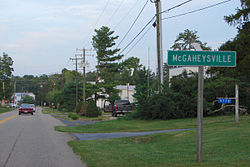
McGaheysville | |
|---|---|
 | |
 Location of the McGaheysville CDP within the Rockingham County | |
| Coordinates: 38°22′31″N 78°43′43″W / 38.37528°N 78.72861°W | |
| Country | |
| State | Virginia |
| County | Rockingham County |
| Population (2020) | |
| • Total | 978 |
| FIPS code | 51-48232 |
| GNIS feature ID | 2807440 |
McGaheysville ( /məˈɡækizvɪl/ mə-GAK-eez-vil) is a Census-designated place located in Rockingham County, in the U.S. state of Virginia.[1] It is located along U.S. Route 33 between Penn Laird and Elkton, and sits at the base of the Massanutten.
According to a number derived from the 2010 census standard, McGaheysville had an estimated population of 4,354 people.[2]
- ^ U.S. Geological Survey Geographic Names Information System: McGaheysville, Virginia
- ^ "Zip-Codes.com MC GAHEYSVILLE, VA". Zip-Codes.com. Retrieved October 14, 2013.

