This article needs additional citations for verification. (May 2010) |
| Medvednica | |
|---|---|
 View of Medvednica from Jarun Lake | |
| Highest point | |
| Peak | Sljeme |
| Elevation | 1,035 m (3,396 ft) |
| Geography | |
 | |
| Country | Croatia |
| Range coordinates | 45°55′N 15°58′E / 45.917°N 15.967°E |
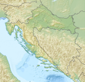
Medvednica (pronounced [mědʋednitsa], lit. 'Bear mountain')[1] is a mountain in central Croatia, just north of Zagreb, and marking the southern border of the historic region of Zagorje. The highest peak, at 1,035 m (3,396 ft) is Sljeme.[2] Most of the area of Medvednica is a nature park (park prirode), a type of preservation lesser than a national park.[3] During Miocene and Pliocene, the mountain was an island within the Pannonian Sea.
- ^ "Mèdvednica" (in Croatian). Znanje d.d. and Srce. Retrieved 1 May 2014.
- ^ Ostroški, Ljiljana, ed. (December 2015). Statistički ljetopis Republike Hrvatske 2015 [Statistical Yearbook of the Republic of Croatia 2015] (PDF). Statistical Yearbook of the Republic of Croatia (in Croatian and English). Vol. 47. Zagreb: Croatian Bureau of Statistics. p. 48. ISSN 1333-3305. Retrieved 27 December 2015.
- ^ Nature Park Medvednica
