Megino-Kangalassky District
Мегино-Кангаласский улус | |
|---|---|
| Other transcription(s) | |
| • Yakut | Мэҥэ-Хаҥалас улууһа |
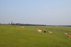
 Grazing livestock near the selo of Mayya in Megino-Kangalassky District | |
 Location of Megino-Kangalassky District in the Sakha Republic | |
| Coordinates: 61°58′N 129°55′E / 61.967°N 129.917°E | |
| Country | Russia |
| Federal subject | Sakha Republic[1] |
| Established | February 10, 1930[2] |
| Administrative center | Mayya[2] |
| Area | |
• Total | 11,700 km2 (4,500 sq mi) |
| Population | |
• Total | 31,278 |
| • Density | 2.7/km2 (6.9/sq mi) |
| • Urban | 11.2% |
| • Rural | 88.8% |
| Administrative structure | |
| • Administrative divisions | 1 Settlements, 29 Rural okrugs |
| • Inhabited localities[2] | 1 Urban-type settlements[4], 35 rural localities |
| Municipal structure | |
| • Municipally incorporated as | Megino-Kangalassky Municipal District[5] |
| • Municipal divisions[6] | 1 urban settlements, 30 rural settlements |
| Time zone | UTC+9 (MSK+6 |
| OKTMO ID | 98629000 |
| Website | https://mr-megino-kangalasskij.sakha.gov.ru |
Megino-Kangalassky District (Russian: Ме́гино-Кангала́сский улу́с; Yakut: Мэҥэ-Хаҥалас улууһа, Meŋe Xaŋalas uluuha, IPA: [meŋe xaŋalas uluːha]) is an administrative[1] and municipal[5] district (raion, or ulus), one of the thirty-four in the Sakha Republic, Russia. It is located in the central part of the republic, on the Lena River opposite Yakutsk, the capital of the republic. The area of the district is 11,700 square kilometers (4,500 sq mi).[2] Its administrative center is the rural locality (a selo) of Mayya.[2] As of the 2010 Census, the total population of the district was 31,278, with the population of Mayya accounting for 23,.3% of that number.[3]
| Year | Pop. | ±% |
|---|---|---|
| 1970 | 25,210 | — |
| 1979 | 27,636 | +9.6% |
| 1989 | 31,623 | +14.4% |
| 2002 | 32,288 | +2.1% |
| 2010 | 31,278 | −3.1% |
| 2021 | 33,298 | +6.5% |
| Source: Census data | ||
- ^ a b Constitution of the Sakha Republic, Article 45
- ^ a b c d e f Registry of the Administrative-Territorial Divisions of the Sakha Republic
- ^ a b Russian Federal State Statistics Service (2011). Всероссийская перепись населения 2010 года. Том 1 [2010 All-Russian Population Census, vol. 1]. Всероссийская перепись населения 2010 года [2010 All-Russia Population Census] (in Russian). Federal State Statistics Service.
- ^ The count of urban-type settlements may include the work settlements, the resort settlements, the suburban (dacha) settlements, as well as urban-type settlements proper.
- ^ a b Law #172-Z #351-III
- ^ Cite error: The named reference
SakhaR_mun1was invoked but never defined (see the help page). - ^ "Об исчислении времени". Официальный интернет-портал правовой информации (in Russian). June 3, 2011. Retrieved January 19, 2019.

