Meherpur Sadar
মেহেরপুর সদর | |
|---|---|
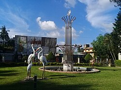
 Park in Meherpur city | |
 | |
| Coordinates: 23°46.5′N 88°38.5′E / 23.7750°N 88.6417°E | |
| Country | |
| Division | Khulna |
| District | Meherpur |
| Area | |
| • Total | 261.42 km2 (100.93 sq mi) |
| Population | |
| • Total | 276,903 |
| • Density | 1,100/km2 (2,700/sq mi) |
| Time zone | UTC+6 (BST) |
| Postal code | 7100[2] |
| Area code | 0791[3] |
| Website | Official Map of Meherpur Sadar |
Meherpur Sadar (Bengali: মেহেরপুর সদর) is an upazila of Meherpur District[4] in the Division of Khulna, Bangladesh. Meherpur is the smallest district of Bangladesh in the south-western part within the Khulna Division. Before 1947, Meherpur was a part of the Nadia district of undivided India. Before 1984, it was a subdivision of Kushtia district. Meherpur consists of 1 municipality, 9 wards and 72 mahallas, 3 upazilas, 18 union parishads, 277 villages, 190 mouzas. The upazilas are Meherpur Sadar, Gangni and Mujibnagar.
- ^ National Report (PDF). Population and Housing Census 2022. Vol. 1. Dhaka: Bangladesh Bureau of Statistics. November 2023. p. 400. ISBN 978-9844752016.
- ^ "Bangladesh Postal Code". Dhaka: Bangladesh Postal Department under the Department of Posts and Telecommunications of the Ministry of Posts, Telecommunications and Information Technology of the People's Republic of Bangladesh. 21 October 2024.
- ^ "Bangladesh Area Code". China: Chahaoba.com. 18 October 2024.
- ^ Gazi Rahman (2012), "Meherpur Sadar Upazila", in Sirajul Islam and Ahmed A. Jamal (ed.), Banglapedia: National Encyclopedia of Bangladesh (Second ed.), Asiatic Society of Bangladesh