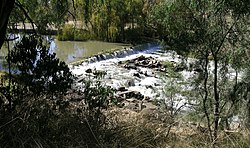
| Mehi River Gwydir River, Meei River[1] | |
|---|---|
 Mehi River Weir at Moree | |
 | |
| Location | |
| Country | Australia |
| State | New South Wales |
| Region | IBRA: Darling Riverine Plains |
| District | Orana |
| Municipalities | Moree Plains, Walgett |
| Physical characteristics | |
| Source | an offtake from the Gwydir River |
| • location | near Pallamallawa |
| • elevation | 227 m (745 ft) |
| Mouth | confluence with the Barwon River |
• location | near Collarenebri |
• elevation | 145 m (476 ft) |
| Length | 314 km (195 mi) |
| Basin features | |
| River system | Murray–Darling basin |
| [2] | |
The Mehi River is a perennial watercourse that is part of the Barwon catchment within the Murray–Darling basin, located in the Orana district of New South Wales, Australia.
The river rises from the Gwydir River west of Pallamallawa, and flows generally west and west-southwest, joined by eight minor tributaries, before reaching its confluence with the Barwon River near Collarenebri. It descends 82 metres (269 ft) over its 314-kilometre (195 mi) course.[2]
- ^ "Mehi River". Geographical Names Register (GNR) of NSW. Geographical Names Board of New South Wales. Retrieved 10 February 2013.
- ^ a b "Map of Mehi River". Bonzle.com. Retrieved 10 February 2013.