| Meije | |
|---|---|
 La Meije | |
| Highest point | |
| Elevation | 3,984 m (13,071 ft) |
| Prominence | 821 m (2,694 ft) |
| Isolation | 9.6 km (6.0 mi) |
| Listing | Alpine mountains above 3000 m |
| Coordinates | 45°00′17″N 6°18′31″E / 45.00472°N 6.30861°E |
| Geography | |
| Location | Isère - Hautes-Alpes, France |
| Parent range | Dauphiné Alps |
| Climbing | |
| First ascent | 1877 by E.B. de Castelnau and P. Gaspard and son |
| Easiest route | Southwest face |

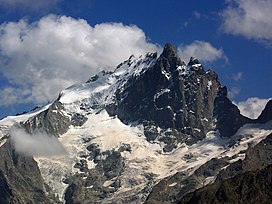
La Meije is a mountain in the Massif des Écrins range, located at the border of the Hautes-Alpes and Isère départements. It overlooks the nearby village of La Grave, a mountaineering centre and ski resort, well known for its off-piste and extreme skiing possibilities, and also dominates the view west of the Col du Lautaret. It is the second highest mountain of the Écrins after the Barre des Écrins.
