Melnytsia-Podilska
Мельниця-Подільська Mielnica Podolska | |
|---|---|
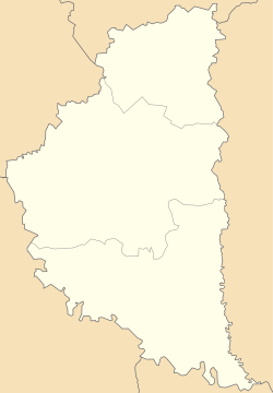
Location of Melnytsia-Podilska in Ternopil Oblast Location of Melnytsia-Podilska in Ukraine | |
| Coordinates: 48°36′22″N 26°10′55″E / 48.60611°N 26.18194°E | |
| Country | |
| Oblast | Ternopil Oblast |
| Raion | Chortkiv Raion |
| Hromada | Melnytsia-Podilska settlement hromada |
| Magdeburg rights | 1747[1] |
| Town status | 1960 |
| Area | |
| • Total | 10 km2 (4 sq mi) |
| Elevation | 260 m (850 ft) |
| Population (2022) | |
| • Total | 3,596 |
| • Density | 360/km2 (930/sq mi) |
| Time zone | UTC+2 (EET) |
| • Summer (DST) | UTC+3 (EEST) |
| Postal code | 48751 |
| Area code | +380 3541 |
| Website | rada.gov.ua |
 | |
Melnytsia-Podilska (Ukrainian: Мельниця-Подільська; Polish: Mielnica; Yiddish: מילניצע, romanized: Melnitse), previously known as Melnytsia-nad-Dnistrom (Ukrainian: Мельниця-над-Днiстром)[3] until 1940, is a rural settlement in Chortkiv Raion, Ternopil Oblast, western Ukraine.[3] It hosts the administration of Melnytsia-Podilska settlement hromada, one of the hromadas of Ukraine.[4] Population: 3,596 (2022 estimate).[5]
The settlement is located in the southernmost part of the province, on the left bank of the Dnister River. To the north is the Khudykovtsi village, and 1.5 kilometres (0.93 mi) to the south is the settlement of Vilkhovets. On the opposite bank of the Dnister lies the village of Perebykivtsi in Dnistrovskyi Raion, Chernivtsi Oblast. The Ukrainian automobile road T-2002 runs through the town.
- ^ "Melnytsia-Podilska". Castles and Churches of Ukraine (in Ukrainian). Retrieved 31 January 2012.
- ^ "Melnytsia-Podilska (Ternopil Oblast)". weather.in.ua (in Ukrainian). Retrieved 31 January 2012.
- ^ a b "Melnytsia-Podilska, Ternopil Oblast, Borshchiv Raion". Regions of Ukraine and their Structure (in Ukrainian). Verkhovna Rada of Ukraine. Archived from the original on 4 March 2016. Retrieved 31 January 2012.
- ^ "Мельнице-Подольская громада" (in Russian). Портал об'єднаних громад України.
- ^ Чисельність наявного населення України на 1 січня 2022 [Number of Present Population of Ukraine, as of January 1, 2022] (PDF) (in Ukrainian and English). Kyiv: State Statistics Service of Ukraine. Archived (PDF) from the original on 4 July 2022.


