This article contains too many pictures for its overall length. (November 2024) |
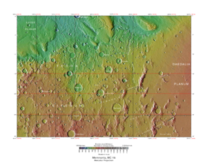
 Map of Memnonia quadrangle from Mars Orbiter Laser Altimeter (MOLA) data. The highest elevations are red and the lowest are blue. | |
| Coordinates | 15°00′S 157°30′W / 15°S 157.5°W |
|---|---|

The Memnonia quadrangle is one of a series of 30 quadrangle maps of Mars used by the United States Geological Survey (USGS) Astrogeology Research Program. The Memnonia quadrangle is also referred to as MC-16 (Mars Chart-16).[1]
The quadrangle is a region of Mars that covers latitude -30° to 0° and longitude 135° to 180°.[2] The western part of Memnonia is a highly cratered highland region that exhibits a large range of crater degradation.
Memnonia includes these topographical regions of Mars:
Recently, evidence of water was found in the area. Layered sedimentary rocks were found in the wall and floor of Columbus Crater. These rocks could have been deposited by water or by wind. Hydrated minerals were found in some of the layers, so water may have been involved.[3]
Many ancient river valleys including Mangala Vallis, have been found in the Memnonia quadrangle. Mangala appears to have begun with the formation of a graben, a set of faults that may have exposed an aquifer.[4] Dark slope streaks and troughts (fossae) are present in this quadrangle. Part of the Medusae Fossae Formation is found in the Memnonia quadrangle.
- ^ Davies, M.E.; Batson, R.M.; Wu, S.S.C. "Geodesy and Cartography" in Kieffer, H.H.; Jakosky, B.M.; Snyder, C.W.; Matthews, M.S., Eds. Mars. University of Arizona Press: Tucson, 1992.
- ^ USGS Astrogeology: Planetary Map Listing
- ^ "HiRISE | Sedimentary Layers in Columbus Crater (PSP_010281_1510)". Hirise.lpl.arizona.edu. Retrieved 2012-08-04.
- ^ "Mars Channels and Valleys". Msss.com. Retrieved 2012-08-04.