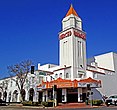
Merced | |
|---|---|
| City of Merced | |
| Coordinates: 37°18′N 120°29′W / 37.300°N 120.483°W | |
| Country | United States |
| State | California |
| County | Merced |
| Incorporated | April 1, 1889[1] |
| Government | |
| • Type | Council–manager[2] |
| • Mayor | Matthew Serratto[3] |
| • State senator | Anna Caballero (D)[4] |
| • Assemblymember | Esmeralda Soria (D)[4] |
| • U.S. rep. | John Duarte (R)[5] |
| Area | |
• Total | 23.25 sq mi (60.2 km2) |
| • Land | 23.25 sq mi (60.2 km2) |
| • Water | 0.00 sq mi (0.0 km2) 0% |
| Elevation | 171 ft (52 m) |
| Population | |
• Total | 86,333 |
| • Rank | 82nd in California |
| • Density | 3,712.61/sq mi (1,433.45/km2) |
| Time zone | UTC−8 (Pacific) |
| • Summer (DST) | UTC−7 (PDT) |
| ZIP codes | 95340–95341, 95344, 95348 |
| Area code | 209 |
| FIPS code | 06-46898 |
| GNIS feature IDs | 1659751, 2411080 |
| Website | www |
Merced (/mɜːrˈsɛd/; Spanish for "Mercy") is a city in, and the county seat of, Merced County, California, United States, in the San Joaquin Valley. As of the 2020 census, the city had a population of 86,333,[8] up from 78,958 in 2010. Incorporated on April 1, 1889, Merced is a charter city that operates under a council–manager government. It is named after the Merced River, which flows nearby.
Merced, known as the "Gateway to Yosemite", is less than two hours by automobile from Yosemite National Park to the east and Monterey Bay, the Pacific Ocean, and multiple beaches to the west. The community is served by the passenger rail service Amtrak, a minor, heavily subsidized airline through Merced Regional Airport, and three bus lines. It is approximately 110 miles (180 km) from Sacramento, 130 miles (210 km) from San Francisco, 55 miles (89 km) from Fresno, and 270 miles (430 km) from Los Angeles.
In 2005, the city became home to the 10th University of California campus, University of California, Merced (UC Merced), the first research university built in the U.S. in the 21st century.[9]
- ^ "California Cities by Incorporation Date". California Association of Local Agency Formation Commissions. Archived from the original (Word) on October 17, 2013. Retrieved August 25, 2014.
- ^ "Merced, CA Code of Ordinances [codes] - Sec. 300. - Form of government". Municode. Retrieved February 4, 2015.
- ^ "Merced City Council". City of Merced, CA. Archived from the original on December 9, 2018. Retrieved September 16, 2014.
- ^ a b "Statewide Database". UC Regents. Archived from the original on February 1, 2015. Retrieved November 21, 2014.
- ^ "California's 13th Congressional District - Representatives & District Map". Civic Impulse, LLC.
- ^ "2021 U.S. Gazetteer Files: California". United States Census Bureau. Retrieved August 25, 2022.
- ^ "Merced". Geographic Names Information System. United States Geological Survey, United States Department of the Interior. Retrieved February 24, 2015.
- ^ a b "P1. Race – Merced city, California: 2020 DEC Redistricting Data (PL 94-171)". U.S. Census Bureau. Retrieved August 25, 2022.
- ^ "UC Merced – Mission Statement". Archived from the original on May 23, 2007. Retrieved February 14, 2019.


