| Methow River | |
|---|---|
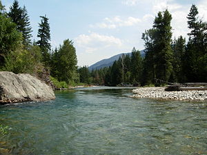
 The Methow River at Mazama | |
| Native name | Buttlemuleemauch |
| Location | |
| Country | United States |
| State | Washington |
| Region | Okanogan County |
| Cities | Winthrop, Twisp, Pateros |
| Physical characteristics | |
| Source | Cascade Range |
| • location | Methow Pass |
| • coordinates | 48°35′9″N 120°44′44″W / 48.58583°N 120.74556°W[1] |
| • elevation | 5,677 ft (1,730 m)[2] |
| Mouth | Columbia River |
• location | Pateros |
• coordinates | 48°3′2″N 119°53′43″W / 48.05056°N 119.89528°W[1] |
• elevation | 784 ft (239 m)[2] |
| Length | 80 mi (130 km)[3] |
| Basin size | 1,825 sq mi (4,730 km2)[4] |
| Discharge | |
| • location | mouth[5] |
| • average | 1,522 cu ft/s (43.1 m3/s)[5] |
| • minimum | 150 cu ft/s (4.2 m3/s) |
| • maximum | 27,200 cu ft/s (770 m3/s) |
| Basin features | |
| Tributaries | |
| • left | Lost River, Chewuch River |
| • right | Early Winters Creek, Twisp River |
The Methow River (/ˈmɛthaʊ/ MET-how)[6] is a tributary of the Columbia River in northern Washington in the United States. The river's 1,890-square-mile (4,900 km2) watershed drains the eastern North Cascades, with a population of about 5,000 people. The Methow's watershed is characterized by relatively pristine habitats, as much of the river basin is located in national forests and wildernesses. Many tributaries drain the large Pasayten Wilderness. An earlier economy based on agriculture is giving way to one based on recreation and tourism.
- ^ a b U.S. Geological Survey Geographic Names Information System: Methow River, USGS GNIS.
- ^ a b Google Earth elevation for GNIS coordinates.
- ^ Methow River Archived 2004-12-24 at the Wayback Machine, The Columbia Gazetteer of North America. 2000.
- ^ "Wenatchee Subbasin Plan". Northwest Power and Conservation Council. Retrieved 30 July 2009.
- ^ a b http://pubs.usgs.gov/wdr/2005/wdr-wa-05-1/ Water Resources Data-Washington Water Year 2005
- ^ Webster's Geographical Dictionary.

