Micheweni | |
|---|---|
|
From top to bottom: Kigomasha lighthouse & Ngezi Forest in northeast Micheweni District | |
| Nickname: Wild Pemba | |
 Location in Pemba North | |
| Coordinates: 4°59′2.4″S 39°45′18″E / 4.984000°S 39.75500°E | |
| Country | |
| Region | Pemba South Region |
| Capital | Konde |
| Area | |
• Total | 231 km2 (89 sq mi) |
| • Rank | 2nd in Pemba North |
| Population (2022) | |
• Total | 123,379 |
| • Rank | 2nd in Pemba North |
| • Density | 530/km2 (1,400/sq mi) |
| Demonym | Michewenian |
| Ethnic groups | |
| • Settler | Swahili |
| • Native | Hadimu |
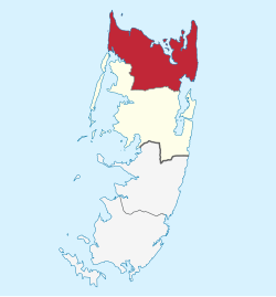
Micheweni District (Wilaya ya Micheweni in Swahili) is one of two administrative districts of Pemba North Region in Tanzania.[1] The district covers an area of 231.1 km2 (89.2 sq mi).[2] The district is comparable in size to the land area of Cook Islands.[3] The district has a water border to the east, north and west by the Indian Ocean. The district is bordered to the south by Wete District. The district seat (capital) is the town of Konde. According to the 2022 census, the district has a total population of 123,379.[4][5]
- ^ "Micheweni District".
- ^ "Micheweni District Profile" (PDF). Government of Zanzibar. 2019. Retrieved 23 July 2022.
- ^ 236.7 km2 (91.4 sq mi) for Cook Islands at "Area size comparison". Nation master. 2022. Retrieved 23 July 2022.
- ^ "Micheweni (District, Tanzania) - Population Statistics, Charts, Map and Location". www.citypopulation.de. Retrieved 2024-02-10.
- ^ "2012 Population and Housing Census General Report" (PDF). Government of Tanzania. Retrieved 2022-06-10.

