| Mickleham | |
|---|---|
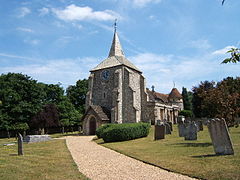
 St Michael's church | |
Location within Surrey | |
| Area | 7.31 km2 (2.82 sq mi) |
| Population | 585 (Civil Parish 2011)[1] |
| • Density | 80/km2 (210/sq mi) |
| OS grid reference | TQ171534 |
| Civil parish |
|
| District | |
| Shire county | |
| Region | |
| Country | England |
| Sovereign state | United Kingdom |
| Post town | Dorking |
| Postcode district | RH5 |
| Dialling code | 01372 or 01306 |
| Police | Surrey |
| Fire | Surrey |
| Ambulance | South East Coast |
| UK Parliament | |
Mickleham is a village in south east England, between the towns of Dorking and Leatherhead in Surrey. The civil parish covers 7.31 square kilometres (1,810 acres) and includes the hamlet of Fredley.[2] The larger ecclesiastical parish includes the majority of the neighbouring village of Westhumble,[3] from which Mickleham is separated by the River Mole.
- ^ Key Statistics; Quick Statistics: Population Density Archived 11 February 2003 at the Wayback Machine United Kingdom Census 2011 Office for National Statistics Retrieved 21 November 2013
- ^ Surrey Council census Archived 28 September 2007 at the Wayback Machine
- ^ "Home". Mickleham Parish Council. Archived from the original on 16 October 2020. Retrieved 14 October 2020.
