| |
|---|---|
 | |
 | |
| Coordinates: 55°53′39″N 3°04′07″W / 55.89417°N 3.06861°W | |
| Country | Scotland |
| Lieutenancy area | Midlothian |
| Admin HQ | Dalkeith |
| Government | |
| • Body | Midlothian Council |
| • Control | SNP minority (council NOC) |
| • MPs |
|
| • MSPs |
|
| Area | |
| • Total | 137 sq mi (354 km2) |
| • Rank | Ranked 21st |
| Population (2022) | |
| • Total | 97,030 |
| • Rank | Ranked 23rd |
| • Density | 710/sq mi (270/km2) |
| ONS code | S12000019 |
| ISO 3166 code | GB-MLN |
| Largest town | Penicuik |
| Website | www |
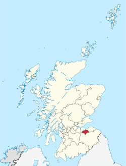
Midlothian (/mɪdˈloʊðiən/; Scottish Gaelic: Meadhan Lodainn) is a historic county, registration county, lieutenancy area and one of 32 council areas of Scotland used for local government. Midlothian lies in the east-central Lowlands, bordering the City of Edinburgh council area, East Lothian and the Scottish Borders.
Midlothian emerged as a county in the Middle Ages under larger boundaries than the modern council area, including Edinburgh itself. The county was formally called the "shire of Edinburgh" or Edinburghshire until the twentieth century. It bordered West Lothian to the west, Lanarkshire, Peeblesshire and Selkirkshire to the south, and East Lothian, Berwickshire and Roxburghshire to the east. Traditional industries included mining, agriculture and fishing—although the modern council area is now landlocked.
