| Milbrulong New South Wales | |
|---|---|
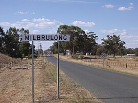
 Entering Milbrulong | |
| Coordinates | 35°15′0″S 146°52′0″E / 35.25000°S 146.86667°E |
| Population | 366 (2006 census)[1] |
| Postcode(s) | 2656 |
| Elevation | 123 m (404 ft) |
| Location |
|
| LGA(s) | Lockhart Shire |
| County | Urana |
| State electorate(s) | Wagga Wagga |
| Federal division(s) | Riverina |
Milbrulong is a locality in the central east part of the Riverina region of New South Wales, Australia.
The locality is 515 kilometres (320 mi) south west of the state capital, Sydney and 59 kilometres (37 mi) south west of the regional centre Wagga Wagga in the Lockhart Shire local government area. The standard gauge Oaklands railway line passes through the locality. The Milbrulong State Forest is located nearby.[2]
At the 2006 census, Milbrulong had a population of 366.[1]
- ^ a b Australian Bureau of Statistics (25 October 2007). "Milbrulong (State Suburb)". 2006 Census QuickStats. Retrieved 30 October 2009.
- ^ "Milbrulong". Lockhart Shire. 2022. Retrieved 24 March 2023.
