Milford, Texas | |
|---|---|
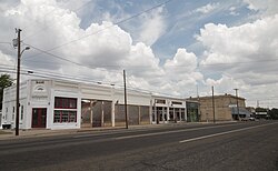
 Downtown Milford in 2010 | |
| Motto: "Small town living with room to grow" | |
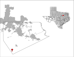
 Location of Milford, Texas | |
 | |
| Coordinates: 32°07′27″N 96°56′57″W / 32.12417°N 96.94917°W | |
| Country | United States |
| State | Texas |
| County | Ellis |
| Area | |
| • Total | 2.47 sq mi (6.39 km2) |
| • Land | 2.46 sq mi (6.37 km2) |
| • Water | 0.01 sq mi (0.02 km2) |
| Elevation | 637 ft (194 m) |
| Population (2020) | |
| • Total | 722 |
| • Density | 303.54/sq mi (117.18/km2) |
| Time zone | UTC-6 (Central (CST)) |
| • Summer (DST) | UTC-5 (CDT) |
| ZIP code | 76670 |
| Area code(s) | 214, 469, 945, 972 |
| FIPS code | 48-48408[3] |
| GNIS feature ID | 2412995[2] |
| Website | cityofmilfordtx |
Milford is an incorporated rural community located in North Central Texas, in the southwestern corner of Ellis County, United States. The population was 722 at the 2020 census.[4]
The town is located 14 miles (23 km) northeast of Hillsboro and 20 miles (32 km) southwest of Waxahachie. The community received media attention due to a Chevron gas pipeline explosion and resulting town evacuation which occurred in 2013.
- ^ "2019 U.S. Gazetteer Files". United States Census Bureau. Retrieved August 7, 2020.
- ^ a b U.S. Geological Survey Geographic Names Information System: Milford, Texas
- ^ "U.S. Census website". United States Census Bureau. Retrieved January 31, 2008.
- ^ "Geographic Identifiers: 2010 Census Summary File 1 (G001): Milford town, Texas". American Factfinder. U.S. Census Bureau. Archived from the original on February 13, 2020. Retrieved March 29, 2016.