Mingo Junction, Ohio | |
|---|---|
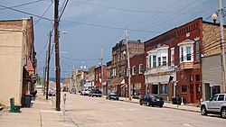
 Downtown Mingo Junction | |
 Location of Mingo Junction in Jefferson County and the state of Ohio | |
| Coordinates: 40°19′17″N 80°36′33″W / 40.32139°N 80.60917°W | |
| Country | United States |
| State | Ohio |
| County | Jefferson |
| Township | Steubenville |
| Government | |
| • Type | Mayor–council |
| Area | |
• Total | 2.86 sq mi (7.41 km2) |
| • Land | 2.69 sq mi (6.97 km2) |
| • Water | 0.17 sq mi (0.44 km2) |
| Elevation | 994 ft (303 m) |
| Population (2020) | |
• Total | 3,347 |
| • Density | 1,244.24/sq mi (480.42/km2) |
| Time zone | UTC-5 (Eastern (EST)) |
| • Summer (DST) | UTC-4 (EDT) |
| ZIP code | 43938 |
| Area code | 740 |
| FIPS code | 39-50904[3] |
| GNIS feature ID | 2399374[2] |
| Website | www |
Mingo Junction is a village in eastern Jefferson County, Ohio, United States, along the Ohio River. The population was 3,347 at the 2020 census. It is part of the Weirton–Steubenville metropolitan area.
- ^ "ArcGIS REST Services Directory". United States Census Bureau. Retrieved September 20, 2022.
- ^ a b "Village of Mingo Junction". Geographic Names Information System. United States Geological Survey, United States Department of the Interior. Retrieved May 13, 2024.
- ^ "U.S. Census website". United States Census Bureau. Retrieved January 31, 2008.