44°58′35″N 93°16′15″W / 44.97639°N 93.27083°W
Minneapolis Skyway System | |
|---|---|
| Builder | Leslie Park |
| Length | 9.5 miles (15.3 km) |
| Owner | Individual buildings |
| Location | Downtown Minneapolis, Minnesota, USA |


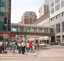
The Minneapolis Skyway System is an interlinked collection of enclosed pedestrian footbridges that connect various buildings in 80 full city blocks over 9.5 miles (15.3 km)[1][2] of Downtown Minneapolis, enabling people to walk in climate-controlled comfort year-round.[3] The skyways are owned by individual buildings in Minneapolis, and as such they do not have uniform opening and closing times.[1] The 9.5 miles of skyway are comparable to the Houston tunnel system, the systems in Canadian cities such as Toronto's PATH, Montreal's Underground City,[4] Calgary's 11-mile Plus 15 system and the 8-mile Edmonton Pedway system.
The Minneapolis skyways connect the second or third floors of various office towers, hotels, banks, corporate and government offices, restaurants, and retail stores to the Nicollet Mall shopping district, the Mayo Clinic Square, and the sports facilities at Target Center, Target Field and U.S. Bank Stadium. Several condominium and apartment complexes are skyway-connected as well, allowing residents to live, work, and shop downtown without having to leave the skyway system.[5]
- ^ a b "Your Guide to Navigating the Minneapolis Skyway System". Meet Minneapolis. Archived (PDF) from the original on May 22, 2022. Retrieved January 4, 2023.
- ^ Marshall, Lillie (April 15, 2019). "Why See the Minneapolis Skyway and Skyline? – Around the World "L"". www.aroundtheworldl.com. Archived from the original on May 11, 2019. Retrieved January 4, 2023.
- ^ "Your Guide to the Minneapolis Skyway System". Meet Minneapolis. Retrieved September 23, 2020.
- ^ Ralph Blumenthal, It’s Lonesome in This Old Town, Until You Go Underground Archived 2017-08-01 at the Wayback Machine, The New York Times, August 21, 2007,
- ^ Sharlene Hensrud. "Minneapolis condos connected to the Skyway". homesmsp.com.