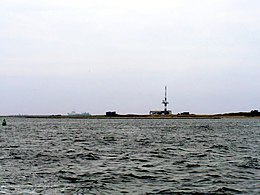
 Minsener Oog seen from the mainland to the south | |
 | |
| Geography | |
|---|---|
| Location | North Sea |
| Coordinates | 53°45′47″N 8°0′48″E / 53.76306°N 8.01333°E |
| Archipelago | East Frisian Islands |
| Area | 3.7 km2 (1.4 sq mi) |
| Length | 4.5 km (2.8 mi) |
| Width | 1.5 km (0.93 mi) |
| Highest elevation | 12 m (39 ft) |
| Administration | |
Germany | |
| Demographics | |
| Population | 0 |
| Minsener Oog Buhne C Lighthouse | |
 | |
| Constructed | 1976 |
| Construction | concrete tower |
| Height | 53 m (174 ft) |
| Shape | cylindrical tower with a communications and radar tower on the summit[1] |
| Markings | tower with white and black horizontal bands |
| Deactivated | 1998 |
| Focal height | 22 m (72 ft) |
| Characteristic | Fl WRG 4s |
Minsener Oog, also Minser Oog or Minsener Oldeoog, is an uninhabited East Frisian island that belongs to the parish of Wangerooge in the north German district of Friesland in the state of Lower Saxony.[2][3] It has been artificially enlarged through the construction of groynes.
- ^ Rowlett, Russ. "Lighthouses of Germany: Borkum to Wilhelmshaven". The Lighthouse Directory. University of North Carolina at Chapel Hill. Retrieved January 30, 2016.
- ^ Koordinierungsstelle GDI-NI beim Landesbetrieb Landesvermessung und Geobasisinformation Niedersachsen: Objektinformationen zu WMS Ebenen Archived 2014-06-12 at the Wayback Machine. In: Geoportal Niedersachsen NiedersachsenViewer Archived 2010-04-13 at the Wayback Machine, Hinweis zur Abfrage: Layer „Verwaltungsgrenzen u. Orte → Gemeindegrenzen“ aktivieren. Abfrage über Werkzeug Info (Symbolleiste oben) und Klick in Umriss der Insel Minsener Oog.
- ^ Landesbetrieb Landesvermessung und Geobasisinformation Niedersachsen: DGM5 Verfügbarkeit Landkreis/Stadt Friesland. As at 23 October 2009[permanent dead link]