| Mirani Dam | |
|---|---|
 Meerani Dam | |
| Official name | میرانی ڈیم |
| Country | Pakistan |
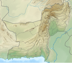
| Location | Kech District, Balochistan |
| Coordinates | 25°56′28″N 62°41′36″E / 25.94111°N 62.69333°E |
| Status | In use |
| Construction began | 8 July 2002[1] |
| Opening date | October 2006 |
| Owner(s) | Government of Pakistan |
| Operator(s) | WAPDA |
| Dam and spillways | |
| Type of dam | Concrete-faced rock-filled |
| Impounds | Dasht River |
| Height | 127 ft (39 m)[2] |
| Length | 3,350 ft (1,020 m) |
| Width (base) | 35 ft (11 m) |
| Reservoir | |
| Creates | Mirani Reservoir |
| Total capacity | (302,000 acre⋅ft (373,000,000 m3) |
| Inactive capacity | (150,000 acre⋅ft (190,000,000 m3) |
| Catchment area | 134 Sq.kilometre Power generation capacity=117 MW |
| Normal elevation | 244 feet (74 metres) Above Mean Sea Level[3] |
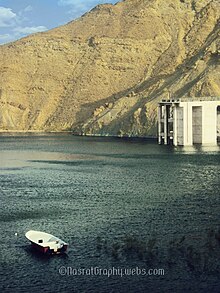
Mirani Dam (Urdu: میرانی ڈیم) is on the Dasht River, south of the Central Makran Range in Kech District in Balochistan province of Pakistan. Its 302,000 acre-feet (373,000,000 m3) reservoir is fed by the Kech River and the Nihing River, which join at Mirani Dam to form the Dasht River.[1] Mirani Dam was completed in July 2006 and began impounding the Dasht River in August 2006.
- ^ a b "Mirani Dam". Scribd.com. 2008-11-10. Retrieved 2013-11-20.
- ^ Cite error: The named reference
yemyinwas invoked but never defined (see the help page). - ^ "Mirani Dam project". DAWN.COM. 14 April 2003. Retrieved 17 May 2017.

