| Mississippi National River and Recreation Area | |
|---|---|
 | |
| Location | Minnesota, United States |
| Nearest city | Minneapolis/St. Paul, Minnesota |
| Coordinates | 44°52′24″N 93°01′08″W / 44.8732995°N 93.018826°W[1] |
| Area | 53,775 acres (21,762 ha)[2] |
| Established | November 18, 1988 |
| Visitors | 127,635 (in 2015)[3] |
| Governing body | National Park Service along with other private organizations. |
| Website | Mississippi National River and Recreation Area |
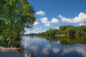
The Mississippi National River and Recreation Area is a 72-mile (116 km) and 54,000-acre (22,000 ha) protected corridor along the Mississippi River through Minneapolis–Saint Paul in the U.S. state of Minnesota, from the cities of Dayton and Ramsey to just downstream of Hastings. This stretch of the upper Mississippi River includes natural, historical, recreational, cultural, scenic, scientific, and economic resources of national significance. This area is the only national park site dedicated exclusively to the Mississippi River. The Mississippi National River and Recreation Area is sometimes abbreviated as MNRRA (often pronounced like "minn-ruh") or MISS, the four-letter code the National Park Service assigned to the area. The Mississippi National River and Recreation Area is classified as one of four national rivers in the United States, and despite its name is technically not one of the 40 national recreation areas.
- ^ "Mississippi National River and Recreation Area". Geographic Names Information System. United States Geological Survey, United States Department of the Interior. Retrieved 2012-12-05.
- ^ "Listing of acreage – December 31, 2011" (XLSX). Land Resource Division, National Park Service. Retrieved 2012-12-26. (National Park Service Acreage Reports)
- ^ "Unknown".[permanent dead link]

