Mizhhiria
Міжгір'я | |
|---|---|
 | |
| Coordinates: 48°31′43″N 23°30′07″E / 48.52861°N 23.50194°E | |
| Country | |
| Oblast | |
| Raion | Khust Raion |
| First mentioned | 1415 |
| Town status | 1947 |
| Government | |
| • Town Head | Vasyl Schur |
| Area | |
| • Total | 4.58 km2 (1.77 sq mi) |
| Elevation | 437 m (1,434 ft) |
| Population (2022) | |
| • Total | |
| Time zone | UTC+2 (EET) |
| • Summer (DST) | UTC+3 (EEST) |
| Postal code | 90000 |
| Area code | +380 3146 |
| Website | http://rada.gov.ua/ |
 | |
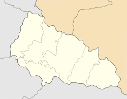
Mizhhiria (Ukrainian: Міжгір'я; Hungarian: Ökörmező; Romanian: Boureni) is a rural settlement in Khust Raion, Zakarpattia Oblast, western Ukraine. The town is also the administrative center of Mizhhiria Raion (district), housing the district's local administration buildings. The town's population was 9,656 as of the 2001 Ukrainian Census.[2] Current population: 9,432 (2022 estimate).[3]
- ^ "Kol'chyno (Zakarpattia Oblast, Mukachevo Raion)". weather.in.ua. Retrieved 18 May 2012.
- ^ "Mizhhiria, Zakarpattia Oblast, Mizhhiria Raion". Regions of Ukraine and their Structure (in Ukrainian). Verkhovna Rada of Ukraine. Retrieved 18 May 2012.[permanent dead link]
- ^ Чисельність наявного населення України на 1 січня 2022 [Number of Present Population of Ukraine, as of January 1, 2022] (PDF) (in Ukrainian and English). Kyiv: State Statistics Service of Ukraine. Archived (PDF) from the original on 4 July 2022.


