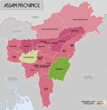
| Lushai Hills (1947–1954) Mizo District (1954–1972) Mizoram[1] | |||||||||
|---|---|---|---|---|---|---|---|---|---|
| Former autonomous district of Assam | |||||||||
| 1947–1972 | |||||||||
 | |||||||||
| Capital | Aizawl | ||||||||
| Population | |||||||||
• 1951 | 196,202[2] | ||||||||
• 1961 | 261,014[3] | ||||||||
• 1971 | 332,339[4] | ||||||||
| Government | |||||||||
| Deputy Commissioner | |||||||||
• 1952–1953 (first)[5] | Shri. S.N. Barkataki | ||||||||
• 1972 (last)[6] | Shri. G.C. Srivastava | ||||||||
| Historical era | Cold War | ||||||||
| 15 August 1947 | |||||||||
• Abolished chieftainship (Lushai Hills Reorganisation of Chiefs’ Rights Act, 1954)[7] | 1954 | ||||||||
• Renamed as Mizo District (The Lushai Hills District (Change of Name) Act, 1954)[8] | 1954 | ||||||||
• Mautam famine | 1959 | ||||||||
| 28 February 1966 | |||||||||
• Granted UT status | 15 August 1972 | ||||||||
| |||||||||
| Today part of | Mizoram | ||||||||
The Mizo District, formerly called Lushai Hills District, was an autonomous district of the Indian state of Assam from 1947 till 1972 until it was granted the status of a Union Territory. This region was a significant part of Mizo history as it formally abolished the Mizo chieftainship system in 1952. It also encountered the 1959 Mautam famine, which led to the Mizo National Front uprising and the subsequent 20-year insurgency.
- ^ "Mizo Chanchin, Bu II – A History of Lushai Hills, Part II [1947]", British Library, EAP454/13/12, https://eap.bl.uk/archive-file/EAP454-13-12
- ^ "Census of India Website: Office of the Registrar General & Census Commissioner, India". www.censusindia.gov.in.
- ^ "Census of India, 1961, District Census Handbook, Lushai Hills, p172"
- ^ "Census of India Website: Office of the Registrar General & Census Commissioner, India". www.censusindia.gov.in.
- ^ "Incumbency Chart | Aizawl District, Government of Mizoram | India".
- ^ "Incumbency Chart | Aizawl District, Government of Mizoram | India".
- ^ https://academic.oup.com/book/10383/chapter-abstract/158192519?redirectedFrom=fulltext
- ^ "Section 3: Amendment of the Sixth Schedule to the Constitution | the Lushai Hills District (Change of Name) Act, 1954".