This article needs additional citations for verification. (December 2015) |
| Mkomazi National Park | |
|---|---|
 | |
| Coordinates | 4°17′58″S 38°23′22″E / 4.29944°S 38.38944°E |
| Area | 3234 km2 |
| Established | 2006 |
| Visitors | 1,587 (in 2012[1]) |
| Governing body | Tanzania National Parks Authority |
| tanzaniaparks | |
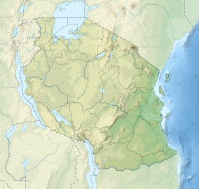
Mkomazi National Park is located in northeastern Tanzania on the Kenyan border, in Same District of Kilimanjaro Region and Lushoto District, with a slither of the park in Mkinga District both of Tanga Region. It was established as a game reserve in 1951 and upgraded to a national park in 2006.[2]
The park covers over 3,234 square kilometres (323,400 ha), and is dominated by Acacia-Commiphora vegetation; it is contiguous with Kenya's Tsavo West National Park. The area commonly called 'Mkomazi' is actually the union of two previous game reserves, the Umba Game Reserve in the east (in Lushoto District, Tanga Region) and the Mkomazi Game Reserve in the west (in Same District, Kilimanjaro Region); in government documents they are sometimes called the Mkomazi-Umba Game Reserves. Of the two, Mkomazi is larger, and has more diversity of relief and habitat, and a longer shared border with Tsavo West National Park. In the rest of this entry, 'Mkomazi' will refer to both the Mkomazi and Umba reserves together.
- ^ "Tanzania National parks Corporate Information". Tanzania Parks. TANAPA. Archived from the original on 20 December 2015. Retrieved 22 December 2015.
- ^ Mbeyale, G.E. and Songorwa, A.N. (2008). Conservation for whose benefit? Challenges and opportunities for management of Mkomazi Game Reserve, Tanzania. People, Protected Areas and Global Change: participatory conservation in Latin America, Africa, Asia and Europe. Perspectives of the Swiss National Centre of Competence in Research (NCCR) North-South, University of Bern, Geographica Bernensia 3: 221−251.
