| Moho River | |
|---|---|
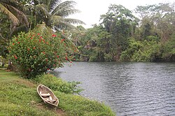
 Moho River at Boom Creek Village in Belize | |
 | |
| Location | |
| Countries | Belize and Guatemala |
| Physical characteristics | |
| Mouth | |
• location | Amatique Bay |
• coordinates | 16°03′35″N 88°51′07″W / 16.05984°N 88.85193°W |
• elevation | 0 m (0 ft) |
| Basin size | 1,188.5 square kilometres (458.9 sq mi)[1] |
The Moho River is a river of Guatemala and Belize.[1] The river is navigable year round between Santa Teresa and the mouth.[2] The size of the Moho basin is 1,188.5 km² (458.9 sq ml).
- ^ a b "Moho River". Biodiversity & Environmental Resource Data System. Belize Tropical Forest Studies. Archived from the original on 9 February 2012. Retrieved 24 February 2017.
- ^ "Moho River". BelizeRivers.org. Archived from the original on 6 February 2006. Retrieved 24 February 2017.