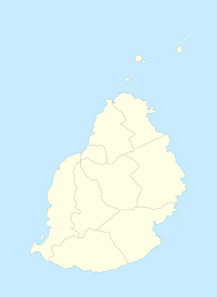
Moka | |
|---|---|
Villages | |
| Coordinates: 20°13′08″S 57°29′46″E / 20.219°S 57.496°E | |
| Country | Mauritius |
| Districts | Moka District |
| Elevation | 203 m (666 ft) |
| Highest elevation | 425 m (1,394 ft) |
| Population (October 2011)[3] | |
• Total | 8,846 |
| • Density | 507.2/km2 (1,314/sq mi) |
| Time zone | UTC+4 (Mauritius Time) |
| Area code | 230 |
| ISO 3166 code | MU |
| Climate | Am |
Moka (Mauritian Creole pronunciation: [moka]) is a village in Mauritius located mainly in the Moka District. The western part of the village lies in the Plaines Wilhems District.[4] Since 1967 it forms part of Constituency No. 8 Quartier Militaire and Moka.[5] The village is administered by the Moka Village Council under the aegis of the Moka District Council.[6] According to the census made by Statistics Mauritius in 2011, the population was at 8,846.[3] The elevation is 203 meters and can be up to 425 meters in some places. Moka is directly on the other side of the Moka Range from Port Louis. The village is close to the mountain Le Pouce and the town Beau-Bassin Rose-Hill. Réduit is a suburb of the village where the State House and University of Mauritius is situated. The village is also home to the Mauritius Broadcasting Corporation and the Mahatma Gandhi Institute.
- ^ "Quick info, Local Time in Moka, Moka, Mauritius". Chinchi.com.
- ^ "What is the elevation of Moka, Mauritius?". WolframAlpha.
- ^ a b "Table G1 - Resident population by geographical location, whereabouts on census night and sex" (PDF). Central Statistic Office. 2011: 3. Archived from the original (PDF) on 2016-03-03. Retrieved 2012-11-29.
{{cite journal}}: Cite journal requires|journal=(help) - ^ Statistics Mauritius (2011). "Housing and population Census 2011" (PDF). Government of Mauritius. Archived from the original (PDF) on 21 October 2013. Retrieved 28 November 2012.
{{cite journal}}: Cite journal requires|journal=(help) - ^ "Electoral areas and Constituencies". Office of the Electoral Commissioner. Retrieved 2021-08-22.
- ^ Ministry of Local Government and Outer Islands. "Local Government Act 2011" (PDF). Government of Mauritius. Archived from the original (PDF) on 14 November 2012. Retrieved 28 November 2012.
{{cite journal}}: Cite journal requires|journal=(help)
