| Mollymook New South Wales | |||||||||||||||
|---|---|---|---|---|---|---|---|---|---|---|---|---|---|---|---|
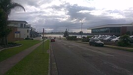
 View of Mollymook Beach from Golf Avenue | |||||||||||||||
| Coordinates | 35°19′47″S 150°28′31″E / 35.32970°S 150.47534°E | ||||||||||||||
| Population | 1,083 (2016 census)[1][2] | ||||||||||||||
| Postcode(s) | 2539 | ||||||||||||||
| Elevation | 19 m (62 ft) | ||||||||||||||
| Location | |||||||||||||||
| LGA(s) | City of Shoalhaven | ||||||||||||||
| Region | South Coast | ||||||||||||||
| County | St Vincent | ||||||||||||||
| Parish | Ulladalla | ||||||||||||||
| State electorate(s) | South Coast | ||||||||||||||
| Federal division(s) | Gilmore | ||||||||||||||
| |||||||||||||||
| |||||||||||||||
Mollymook is a town located on the South Coast of New South Wales, Australia approximately three hours' drive south of Sydney within the City of Shoalhaven local government area.[3][4] At the 2016 census, Mollymook had a population of 1,083[1] while the adjacent locality of Mollymook Beach was home to a further 2,447 people.[2] Geographically, Mollymook is considered part of the Milton-Ulladulla district, a coastal corridor of urban development stretching from Burrill Lake, south of Ulladulla to Mollymook's northern neighbour, Narrawallee and the historic town of Milton a few kilometres inland.
Mollymook is an area that consists of two different localities. The first one is called Mollymook Beach, which is mostly residential and includes Bannister Headland adjacent to Narrawallee. The second one is simply called Mollymook, and it comprises the Mollymook golf and surf lifesaving clubs, as well as motels and serviced apartments.
The name "Mollymook" is believed to be derived from mollymawk. It is the name given by sailors to small species of albatross.[5]
- ^ a b Australian Bureau of Statistics (27 June 2017). "Mollymook (state suburb)". 2016 Census QuickStats. Retrieved 10 July 2017.
- ^ a b Australian Bureau of Statistics (27 June 2017). "Mollymook Beach (state suburb)". 2016 Census QuickStats. Retrieved 10 July 2017.
- ^ "Mollymook". Geographical Names Register (GNR) of NSW. Geographical Names Board of New South Wales. Retrieved 2 February 2018.
- ^ "Mollymook Beach". OpenStreetMap. Retrieved 2 February 2018.
- ^ "Towns and Villages of the Shoalhaven". Shoalhaven City Council. Retrieved 6 April 2013.
