Mondulkiri
មណ្ឌលគិរី | |
|---|---|
| Mondulkiri Province ខេត្តមណ្ឌលគិរី | |
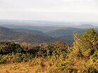
Top: Mondulkiri’s landscape Bottom: Kouprey roundabout | |
 Map of Cambodia highlighting Mondulkiri | |
| Coordinates: 12°27′N 107°14′E / 12.450°N 107.233°E | |
| Country | |
| Provincial status | 30 December 1961 |
| Capital | Senmonorom |
| Government | |
| • Governor | Thong Savon (CPP) |
| • National Assembly | 1 / 125
|
| Area | |
• Total | 14,288 km2 (5,517 sq mi) |
| • Rank | 1st |
| Population (2023)[1] | |
• Total | |
| • Rank | 23rd |
| • Density | 6/km2 (20/sq mi) |
| • Rank | 25th |
| Time zone | UTC+07:00 (ICT) |
| Dialing code | +855 |
| ISO 3166 code | KH-11 |
| Website | mondulkiri |
| [2] | |
Mondulkiri (Khmer: មណ្ឌលគិរី, UNGEGN: Môndôlkĭri, ALA-LC: Maṇḍalagirī [mɔndɔl.kiriː]; lit. 'Center of Mountains') is a province (khaet) of Cambodia. Bordering the provinces of Kratié to the west, Stung Treng to the northwest, Ratanakiri to the north, and the country of Vietnam to the east and south. It is the most sparsely populated province in the country despite being the largest in land area. The province was established in 1961 from the eastern part of Kratié province. The capital is the town of Senmonorom.
The province's symbol is the kouprey which is also Cambodia's national mammal.
- ^ "General Population Census of the Kingdom of Cambodia 2019 – Final Results" (PDF). National Institute of Statistics. Ministry of Planning. 26 January 2021. Retrieved 3 February 2021.
- ^ Cite error: The named reference
urlMondulkiri-geographywas invoked but never defined (see the help page).


