Monivea
Muine Mheá (Irish) | |
|---|---|
Village | |
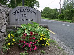
 "Welcome" signage | |
| Coordinates: 53°22′28″N 8°42′15″W / 53.3744°N 8.7043°W | |
| Country | Ireland |
| Province | Connacht |
| County | County Galway |
| Elevation | 83 m (272 ft) |
| Population | 456 |
| Time zone | UTC+0 (WET) |
| • Summer (DST) | UTC-1 (IST (WEST)) |
| Irish Grid Reference | M535354 |
Monivea (Irish: Muine Mheá)[2] is a village in County Galway, Ireland. It is located approximately 30 km from Galway City and 9 km from Athenry.
It was formerly part of the kingdom of the Soghain of Connacht. Monivea is known for its forest, Monivea Castle which now lies in partial ruins, and a well-preserved mausoleum. The mausoleum and castle were built by the Ffrench family, one of the "Tribes of Galway",[3] who were also responsible for the distinctive layout of the greens in the centre of the village, which were used as drying stations for the linen (known as flax) of local industries.[4][5] The forest, mausoleum and castle were left to the State by the last Ffrench, and the forest is now held by Coillte.
There are two small grocery shops one with a petrol station, a butcher shop, four pubs, a Garda station, a post office, a playground, a church in Ryehill, and Monivea National School.
- ^ "Profile 1 - Population Distribution and Movement F1015 - Population: Monivea, Co. Galway". Central Statistics Office (Ireland). Retrieved 21 July 2023.
- ^ "Monivea / Muine Mheá". logainm.ie. Irish Placenames Commission. Retrieved 24 December 2019.
- ^ "Edited Guide Entry: Monivea, County Galway, Ireland". BBC. 18 January 2001. Retrieved 5 May 2009.
- ^ ffrench family details; downloaded Feb 2010
- ^ Irish Times 9 Feb 2010, p.15.
