| Monks Risborough | |
|---|---|
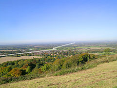
 Monks Risborough looking north from near the top of Whiteleaf Hill (The white line shows very approximately the western boundary with Princes Risborough beyond | |
Location within Buckinghamshire | |
| OS grid reference | SP8004 |
| Civil parish | |
| Unitary authority | |
| Ceremonial county | |
| Region | |
| Country | England |
| Sovereign state | United Kingdom |
| Post town | Princes Risborough |
| Postcode district | HP27 |
| Dialling code | 01844 |
| Police | Thames Valley |
| Fire | Buckinghamshire |
| Ambulance | South Central |
| UK Parliament | |
Monks Risborough is a village and ecclesiastical parish in the civil parish of Princes Risborough, Buckinghamshire, England, lying between Princes Risborough and Great Kimble. The village lies at the foot of the northern scarp of the Chiltern Hills. It is 8 miles (13 km) south of the county town of Aylesbury and 9.5 miles (15.3 km) north of High Wycombe, on the A4010 road.
Until 1934 Monks Risborough was also a separate civil parish, but it now forms part of the much enlarged civil parish of Princes Risborough, with the exception of Meadle and Owlswick, which are both now in the civil parish of Longwick-cum-Ilmer.
The boundaries of the ecclesiastical parish of Monks Risborough are almost the same as the former Manor of Monks Risborough and of the original estate laid out in the 8th or 9th century. References to the 'parish' are therefore to the area covered by the ecclesiastical parish unless otherwise stated.[1]
The ecclesiastical parish of Monks Risborough includes the hamlets of Meadle, Owlswick, Askett, Cadsden and Whiteleaf.
- ^ Large scale plans of the parish (with field names) can be found in Rogers & Lascelles
