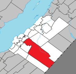
Mont-Carmel | |
|---|---|
 | |
 Location within Kamouraska RCM | |
| Coordinates: 47°26′23″N 69°51′31″W / 47.43972°N 69.85861°W[1] | |
| Country | |
| Province | |
| Region | Bas-Saint-Laurent |
| RCM | Kamouraska |
| Constituted | July 1, 1855 |
| Government | |
| • Mayor | Pierre Saillant |
| • Federal riding | Montmagny—L'Islet—Kamouraska—Rivière-du-Loup |
| • Prov. riding | Côte-du-Sud |
| Area | |
| • Total | 438.60 km2 (169.34 sq mi) |
| • Land | 428.26 km2 (165.35 sq mi) |
| Population | |
| • Total | 1,160 |
| • Density | 2.7/km2 (7/sq mi) |
| • Pop 2016-2021 | |
| • Dwellings | 713 |
| Time zone | UTC−5 (EST) |
| • Summer (DST) | UTC−4 (EDT) |
| Postal code(s) | |
| Area code(s) | 418 and 581 |
| Highways | |
| Website | www |
Mont-Carmel is a municipality in the Canadian province of Quebec, located in the Kamouraska Regional County Municipality, on the Canada–United States border.
