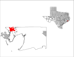
Mont Belvieu, Texas | |
|---|---|
 Location of Mont Belvieu, Texas | |
 | |
| Coordinates: 29°51′37″N 94°52′28″W / 29.86028°N 94.87444°W | |
| Country | United States |
| State | Texas |
| Counties | Chambers |
| Area | |
| • Total | 16.46 sq mi (42.62 km2) |
| • Land | 16.13 sq mi (41.77 km2) |
| • Water | 0.33 sq mi (0.85 km2) |
| Elevation | 69 ft (21 m) |
| Population | |
| • Total | 7,654 |
| • Density | 407.61/sq mi (157.38/km2) |
| Time zone | UTC-6 (Central (CST)) |
| • Summer (DST) | UTC-5 (CDT) |
| ZIP code | 77580 |
| Area code | 281 |
| FIPS code | 48-49068[3] |
| GNIS feature ID | 1341809[4] |
| Website | www |
Mont Belvieu is a city in Chambers County in the U.S. state of Texas. It is just north of Interstate 10 along State Highway 146. The population is currently 11,922 and was 7,654 at the 2020 census, an increase of nearly 100% from 3,835 in 2010.[5] It is the site of the largest underground storage facility for liquefied petroleum gas in the US. The US LPG market pricing indicator is driven primarily by the Mont Belvieu market, and reported daily by the US Energy Administration.
- ^ "2019 U.S. Gazetteer Files". United States Census Bureau. Retrieved August 7, 2020.
- ^ Cite error: The named reference
Census 2010was invoked but never defined (see the help page). - ^ "U.S. Census website". United States Census Bureau. Retrieved January 31, 2008.
- ^ "US Board on Geographic Names". United States Geological Survey. October 25, 2007. Retrieved January 31, 2008.
- ^ "2010 Census Redistricting Data Summary File (P.L. 94-171)". United States Census Bureau. U.S. Department of Commerce Bureau of the Census. Retrieved April 1, 2011.