| Col du Mont Cenis | |
|---|---|
| Italian: Colle del Moncenisio | |
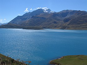
 Lake at the pass | |
| Elevation | 2,085 m (6,841 ft) |
| Traversed by | Route nationale 6 |
| Location | Savoie, France |
| Range | Graian Alps/Cottian Alps |
| Coordinates | 45°15′37″N 06°54′03″E / 45.26028°N 6.90083°E |

Mont Cenis (French pronunciation: [mɔ̃ s(ə)ni]; Italian: Moncenisio, pronounced [montʃeˈnizjo]) is a massif in Savoie (France) (with an elevation of 3,612 m (11,850 ft) at Pointe de Ronce and a pass at an elevation of 2,085 m (6,841 ft)), which forms the limit between the Cottian and Graian Alps.
