Montgomery-Gibbs Executive Airport Gibbs AF Auxiliary Field | |||||||||||||||||||
|---|---|---|---|---|---|---|---|---|---|---|---|---|---|---|---|---|---|---|---|
 | |||||||||||||||||||
| Summary | |||||||||||||||||||
| Airport type | Public | ||||||||||||||||||
| Operator | City of San Diego | ||||||||||||||||||
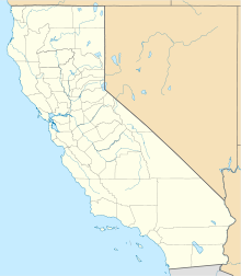
| Location | San Diego, California | ||||||||||||||||||
| Elevation AMSL | 427 ft / 130.1 m | ||||||||||||||||||
| Coordinates | 32°48′57″N 117°08′22″W / 32.81583°N 117.13944°W | ||||||||||||||||||
| Maps | |||||||||||||||||||
 FAA airport diagram | |||||||||||||||||||
 | |||||||||||||||||||
| Runways | |||||||||||||||||||
| |||||||||||||||||||
| Helipads | |||||||||||||||||||
| |||||||||||||||||||
| Statistics (2019) | |||||||||||||||||||
| |||||||||||||||||||

Montgomery-Gibbs Executive Airport (IATA: MYF, ICAO: KMYF, FAA LID: MYF) is a public airport in San Diego, California, United States, six miles (10 km) north of downtown San Diego. The airport covers 456 acres (185 ha) and has three runways, one public helipad, and two private helipads. The runways are 28R/10L and 28L/10R (parallel) and 5/23.
- ^ FAA Airport Form 5010 for MYF PDF, effective 2007-07-05

