Montgomery County | |
|---|---|
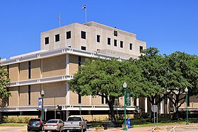
 The Montgomery County Courthouse in Conroe | |
 Location within the U.S. state of Texas | |
 Texas's location within the U.S. | |
| Coordinates: 30°18′N 95°30′W / 30.3°N 95.5°W | |
| Country | |
| State | |
| Founded | 1837 |
| Named for | Montgomery, Texas |
| Seat | Conroe |
| Largest community | The Woodlands |
| Area | |
| • Total | 1,077 sq mi (2,790 km2) |
| • Land | 1,042 sq mi (2,700 km2) |
| • Water | 35 sq mi (90 km2) 3.3% |
| Population (2020) | |
| • Total | 620,443 |
| • Estimate (2023) | 711,354 |
| • Density | 580/sq mi (220/km2) |
| Time zone | UTC−6 (Central) |
| • Summer (DST) | UTC−5 (CDT) |
| Congressional districts | 2nd, 8th |
| Website | www |
Montgomery County is a county in the U.S. state of Texas. As of the 2020 U.S. census, the county had a population of 620,443.[1] The county seat is Conroe.[2] The county was created by an act of the Congress of the Republic of Texas on December 14, 1837, and is named for the town of Montgomery.[3] Between 2000 and 2010, its population grew by 55%, the 24th-fastest rate of growth of any county in the United States. Between 2010 and 2020, its population grew by 36%. According to the U.S. Census Bureau, the estimated population is 711,354 as of July 1, 2023.
Montgomery County is part of the Houston–The Woodlands–Sugar Land metropolitan statistical area.
- ^ "U.S. Census website". United States Census Bureau. Retrieved December 13, 2021.
- ^ "Find a County". National Association of Counties. Retrieved June 7, 2011.
- ^ Searle, Kameron K. The Early History of Montgomery, Texas. City of Montgomery, Texas: July 7, 2012. Accessed on June 5, 2021.