Montvale, New Jersey | |
|---|---|
 Montvale borough hall | |
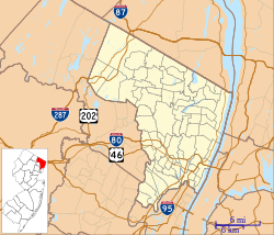
 Location of Montvale in Bergen County highlighted in red (left). Inset map: Location of Bergen County in New Jersey highlighted in orange (right). | |
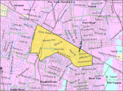
 Census Bureau map of Montvale, New Jersey | |
Location in Bergen County Location in New Jersey | |
| Coordinates: 41°03′17″N 74°02′50″W / 41.054594°N 74.047298°W[1][2] | |
| Country | |
| State | |
| County | Bergen |
| Incorporated | August 31, 1894 |
| Government | |
| • Type | Borough |
| • Body | Borough Council |
| • Mayor | Michael N. Ghassali (R, term ends December 31, 2023)[3][4] |
| • Administrator | Joseph Voytus[5] |
| • Municipal clerk | Fran Scordo[5] |
| Area | |
| • Total | 4.03 sq mi (10.45 km2) |
| • Land | 4.02 sq mi (10.42 km2) |
| • Water | 0.01 sq mi (0.03 km2) 0.25% |
| • Rank | 298th of 565 in state 21st of 70 in county[1] |
| Elevation | 338 ft (103 m) |
| Population | |
| • Total | 8,436 |
| • Estimate | 9,361 |
| • Rank | 280th of 565 in state 48th of 70 in county[12] |
| • Density | 2,096.9/sq mi (809.6/km2) |
| • Rank | 286th of 565 in state 56th of 70 in county[12] |
| Time zone | UTC−05:00 (Eastern (EST)) |
| • Summer (DST) | UTC−04:00 (Eastern (EDT)) |
| ZIP Code | |
| Area code(s) | 201[15] |
| FIPS code | 3400347610[1][16][17] |
| GNIS feature ID | 0885306[1][18] |
| Website | www |
Montvale is a borough in northern Bergen County, in the U.S. state of New Jersey, bordering the state of New York. The borough is part of the New York City metropolitan area. As of the 2020 United States census, the borough's population was 8,436,[9][10] an increase of 592 (+7.5%) from the 2010 census count of 7,844,[19][20] which in turn reflected an increase of 810 (+11.5%) from the 7,034 counted in the 2000 census.[21]
- ^ a b c d 2019 Census Gazetteer Files: New Jersey Places, United States Census Bureau. Accessed July 1, 2020.
- ^ US Gazetteer files: 2010, 2000, and 1990, United States Census Bureau. Accessed September 4, 2014.
- ^ Cite error: The named reference
MayorCouncilwas invoked but never defined (see the help page). - ^ 2023 New Jersey Mayors Directory, New Jersey Department of Community Affairs, updated February 8, 2023. Accessed February 10, 2023.
- ^ a b Borough Directory, Borough of Montvale. Accessed March 14, 2023.
- ^ Cite error: The named reference
DataBookwas invoked but never defined (see the help page). - ^ "ArcGIS REST Services Directory". United States Census Bureau. Retrieved October 11, 2022.
- ^ U.S. Geological Survey Geographic Names Information System: Borough of Montvale, Geographic Names Information System. Accessed March 8, 2013.
- ^ a b c Cite error: The named reference
Census2020was invoked but never defined (see the help page). - ^ a b Cite error: The named reference
LWD2020was invoked but never defined (see the help page). - ^ Cite error: The named reference
PopEstwas invoked but never defined (see the help page). - ^ a b Population Density by County and Municipality: New Jersey, 2020 and 2021, New Jersey Department of Labor and Workforce Development. Accessed March 1, 2023.
- ^ Look Up a ZIP Code for Montvale, NJ, United States Postal Service. Accessed December 20, 2011.
- ^ Zip Codes, State of New Jersey. Accessed August 28, 2013.
- ^ Area Code Lookup - NPA NXX for Montvale, NJ, Area-Codes.com. Accessed August 28, 2013.
- ^ U.S. Census website, United States Census Bureau. Accessed September 4, 2014.
- ^ Geographic Codes Lookup for New Jersey, Missouri Census Data Center. Accessed April 1, 2022.
- ^ US Board on Geographic Names, United States Geological Survey. Accessed September 4, 2014.
- ^ Cite error: The named reference
Census2010was invoked but never defined (see the help page). - ^ Cite error: The named reference
LWD2010was invoked but never defined (see the help page). - ^ Table 7. Population for the Counties and Municipalities in New Jersey: 1990, 2000 and 2010, New Jersey Department of Labor and Workforce Development, February 2011. Accessed May 1, 2023.


